
The Land
44.30 acres · 17.93 hectares
Nineteen acres of pasture, twenty-two acres of woodland, and a stream between them.
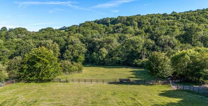
To the south of the farmstead, reached by a hard track, the well-fenced paddocks slope gently down to a stream — a tributary of the Umborne Brook. On the far side of the water is a block of native woodland with rides cut through it for access, and a timber cabin tucked away inside, used as a hide for watching wildlife or for picnics. There is further pastureland and woodland to the west.
The land gives the house both protection and use. It also gives it privacy: the valley is self-contained, and what is not owned is mostly looking the other way.
- Pasture
- 19.07 acres7.72 hectares
- Woodland
- 21.89 acres8.86 hectares
- In all
- 44.30 acres17.93 hectares
- Flood risk
- Zone 1Very low probability
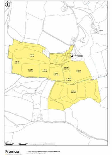
The shape of it
Parcel by parcel
The largest single block is the woodland to the south, of nearly fifteen acres. North and west of the farmstead the pasture is divided into paddocks of between one and seven acres, well fenced and served by the track.
A more detailed plan, showing the curtilage, the extent of a grazing licence, the woodland and the line of the stream, is available below — together with a historic Ordnance Survey sheet showing the original perimeter of the estate.
Habitat
Conservation and ecology
The variety is the point. Grazed pasture, hedgerow, streamside, wet ground, and twenty-two acres of native broadleaf woodland make a range of habitats within a single boundary, and the wildlife follows accordingly.
It will suit a number of different lives: the equestrian, given the paddocks, the stabling and a general purpose building that would convert to American-style boxes; the self-sufficient; or simply anyone who wants an unspoilt place and the quiet to enjoy it.
Things worth knowing
| Public footpath | A fenced-off public footpath skirts the northern boundary, unobtrusively. |
|---|---|
| Water to the Wing | Halshayne Manor Farm supplies water to Halshayne Wing, for domestic use only. |
| Neighbouring water ram | A neighbouring property's water ram sits in the woodland across the valley. |
| Grazing licence | Part of the land is shown on the boundary plan as subject to a grazing licence. |
| Sporting rights | All rights are understood to be owned and to be included with the land. |
Areas and distances are approximate and are taken from the property particulars and the plotted boundary plan. Anyone relying on them should have them checked.